ASHEVILLE, NC / ACCESSWIRE / June 15, 2023 / Ecobot, the platform driving the digitization of mandatory pre-construction environmental assessments, today launched an interactive ArcGIS StoryMap to help environmental consultants and citizens understand how the recent Sackett v. EPA ruling by the Supreme Court of the United States (SCOTUS) will play out across the country based on existing local, state, […]
I Got Vaccinated! Story Map Shares the Who & Where of #COVID-19 Vaccinations
A good story(map) story tip via our friend Joseph Kerski of Esri… “Our health team at Esri worked with GISCorps who is hosting this application where people can share their vaccination stories and approving submissions.”
Esri and UN Launch Global Storytelling Competition
Competition Encourages Use of Geospatial Software to Spread Awareness of Sustainable Development REDLANDS, Calif.—Esri, the global leader in location intelligence, and the United Nations (UN) Sustainable Development Solutions Network (SDSN) have launched the 2020 ArcGIS StoryMaps Competition for the Sustainable Development Goals. The SDSN is a leading nongovernmental organization (NGO) working to mobilize global scientific […]
Tell your StoryMaps Story! #YourSDGstory
Are you a Story Mapper who loves to tell multi-media, feature-rich stories using the ArcGIS Online Story Maps tools? Well, here’s your opportunity to be recognized by sharing a story of your sustainable development goals. From Esri… Are you ready to join storytellers worldwide in a competition for positive change? For this year’s annual StoryMaps […]
Story Map Answers: How have Canadians voted in the past 5 federal elections?
With the 2015 federal elections only a few days away, Esri Canada has released a new story map that helps the public compare results from the last 5 federal elections
The Hidden Cost of EDU Suspension: A Story Map by BlueRaster
The crew at BlueRaster has recently launched a story map and individual maps on suspension rates for the Department of Education and the White House.
CloudCities released – A 3D YouTube For Your Smart City
Today SmarterBetterCities has announced the public release of CloudCities (https://cloudciti.es):
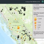
Wildfires in British Columbia (Story Map) – How many are caused by Humans?
Those of you following the current wildfire situation in British Columbia, Canada as well as the smoky haze covering much of the Pacific NorthWest will find this of interest – enter the Story Map by Erin Philip, GIS analyst, Piers Consulting
StoryMap – A Nation of Drones: Map of UAV No Fly Zones
This interesting StoryMap featured on the story Map Gallery shows places in America where you can’t legally fly including, near airports, military bases, and other risky spots. There’s also a number od drone videos on the map – enjoy!
Interactive Esri Maps Explore Poverty in the US and Across the Globe
Esri has created two maps that explain how poverty affects billions of people around the world.


