This year was my 17th consecutive ESRIUC and once again I’ve returned home a little weary and tired from all the Geo Awesomeness that was the ESRIUC. Describing everything in one blog post is pretty much impossible, however, I have shared some of my favorite blog readings HERE, hopefully you’ll find that list useful. I’m often asked by colleagues, “What got your attention at UC?” Indeed there isn’t a quick answer for this as there really was so much to see and digest. There were, however, 10 things that jumped out at me and I’m pleased to share in Top 10 style, much the way I do every year. And so, please find 10 Things that turned my head at ESRIUC (in no particular order), along with several “bonus” inclusions.
The Living Atlas
GIS is all about the data, it always has been and I’ve been saying that since 1999 I think. ArcGIS Online is the platform, however, without rich, 3D data, what’s the point right? ArcGIS Online is the gateway that Esri wants you to use as your access point for feature rich, 3D, raster and vector data and media. As AGO matures we are now hearing about the next step in the evolution – The Living Atlas http://doc.arcgis.com/en/living-atlas/. This Atlas in the cloud is just what you would think, a living, growing, and evolving data rich resource from the Community. Users of ArcGIS Online can search, browse, share and use maps and data from the Atlas and what’s really cool in my mind is that users can now also share their Story Maps with the World by contributing them to the Living Atlas. Back in April when the Living Atlas was officially announced by Esri (See blog post from Dean Kensok, April 2015 http://blogs.esri.com/esri/arcgis/2015/04/07/introduction-to-the-living-atlas-community/) there were more than 1 million maps, data products and services that made up the Atlas and this catalog continues to grow. All content is qualified and curated by the community, ensuring that the data re usable, useful, and reliable. You can share your data by visiting the Living Atlas Contributor App – http://livingatlas.arcgis.com/contribute/
The Startup Zone
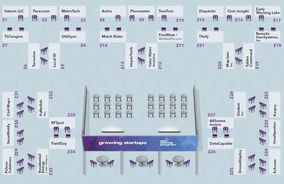
Well, actually there were 35 things here… 35 startups that is! The StartUp zone is where the Esri Startups program team (@EsriStartups) showcases some of their member companies. these are small companies that are doing great things and are given support by Esri in order to kickstart their ideas. To qualify, businesses needed to build software products, be less than three years old and generate less than $1 million in annual revenues. Member companies were showing off amazing technology leveraging Esri’s software and data services. A number of Startups had amazing UAV related technologies (DroneDeploy, Remote GeoSystems, and …) while security offerings were also well represented (Echosec, Antris are good examples). See more about the Startup Zone
The BIG Mapbox sign!
Every year there’s always one or two companies that “crash the party”, so to speak! This year there was CartoDB and MapBox. As seen below, MapBox, who recently scored a whacking pantload of VC, responded by grabbing a visible piece of signage real estate directly outside the SDCC where pretty much every single attendee would walk past at least a couple of times a day – I overheard one Esri staffer walking behind me say “Why didn’t we grab that real estate?” There was even mention in the opening plenary regarding Esri working on and contributing to the MapBox Open vector tile spec! Not wasting any time, MapBox has also just announced a completely redesigned visual interface. You can read about it on their blog.
Not missing an opportunity, MapBox, CartoDB, and even CEO Eric Gundersen (@ericg) and crew took to Twitter with much activity from San Diego. MapBox quenched the thirst of developers on Tuesday evening with a full blown, open bar pizza and tattoo party – it really was a blast! CartoDB was clever and popular as they shmoozed geeks and business prospects in the harbor on the CartoDB boat – The company did also have a pretty big product announcement during the week as well! The boat even had its own popular hashtag #UCboat – these guys get my Gorilla marketing award for UC 2015! See https://twitter.com/andrewxhill/status/623197363591446528
The @cartoDB #UCBoat Brilliant! With @andrewxhill and @andrewbt crewing pic.twitter.com/nn5FXrMge2
— rcheetham (@rcheetham) July 21, 2015
Drones, errrr UAVs on the floor!
It was pointed out to me on a couple of occasions that the aerial solutions creating all the buzz are UAVs (or UAS) and NOT drones and there were plenty of them to be found at ESRIUC this year. It seems that there’s no shortage of hardware, software, and service providers that are anxiously waiting for the FCC to open up the skies and allow UAV flight missions to take off. Large companies like Trimble had enterprise class UAV technology on display like their Gatewing “bird” as well as an impressive copter style unit with 6 rotors. Smaller startups (kespry, Remote Geosystems) and many others were touting turn-key solutions that are pretty much out of the box and designed to UAV enable any consulting firm or solution provider right from the starting point of flight mission planning, to aerial data capture, through 3D processing and image analysis and rectification – there’s some awesome solutions out there!
Geocortex Insight
I may be a little biased as these guys are from Canada, however, Geocortex did indeed deliver! The Victoria, BC-based Esri Platinum Business partner waited until the end of the day on Wednesday to introduce their latest offering, Geocortex Insight. Think deep data analytics and server Insight via a very pleasant to use and understand dashboard. Latitude Geographics CEO, Steven Myhill-Jones is expecting this latest solution to be “Huge” and judging by the response from the huge crowd gathered around the live demo and Q&A he just may be right! Stay tuned for more and be sure to watch @Geocortex on twitter for more info. See also www.geocortex.com – Note, I filmed part of the Insight demo and you can view it on youtube
Developers, Developers…
The Geogeeks were getting loads of attention at the UC, even though they also have their very own, dedicated DevSummit each Spring in Palm Springs! The EDN gang had plenty of stuff going on ranging from a huge area tucked away at one end of the exhibition hall where solution architects could chat and discuss usability issues, APIs, and code. They also had special networking and presentation events including Speed Geeking, Lightning Talks, and the very popular GeoDev Meetup. The Wed night DevMeetUp, which has become an annual event on the Terrace at the Marriott, had well over 200 registered attendees (I’m thinking 300 showed up for beer and food), and developers had a chance to swap stories over beer (hey Jack, they need more beer & food allowance next year!!), and listen to several lightning talks. A couple of attendees walked away with nice prizes including a full reg for the 2016 DevSummit. Stay in touch with the Esri GeoGeeks at http://www.esri.com/events/geodev-meetups
K-12 Wonder Kids
Each year during the plenary, Jack turns the stage over to the Esri K-12 EDU team and we hear from a specially selected high school group about an amazing project they’ve worked on over the past year(s). This year was no different as a pair of high school students from Molokai, Hawaii shared how they are using Geo technology, including ArcGIS online to tackle a local environmental issue, in this case it was the advancement (or Marching) of the Mangroves in Hawaii. Two sisters were completely calm in front of 10,000 of their pers and delivered an awesome presentation of their research, sharing their methodologies and findings. They even calmly recovered from a Crash during the demo, and Wow’d Jack Dangermond when they told him they had made the switch from ArcMap to ArcGIS Pro in less than a week. Truly awesome and inspirational indeed. See the video of their presentation in my blog post
Avenza Systems and the Map Store
Full disclosure, Avenza Systems has been a long time supporter and advertiser on GISuser.com, however, that aside, I always make the time to have a one on one with Ted Florence, CEO and get caught up on his flagship product, chat some hockey, and get some candid comments about life as a software solution provider. This year Ted pulled out his iPad and showed me the most recent build of PDF Maps (http://www.avenza.com/pdf-maps) and as usual, I was wow’d! Recall, PDF Maps is available as a free client for iOS and Android users and enables users to have rapid access to their maps any time, any place. Don’t think of it as a simple map viewer though, although it does do that VERY well, as you can work disconnected, and also perform pretty powerful data capture using the software as well. Create custom forms, collect data, share in real time and much more. Florence showed me some hydrographic charts using the software and we panned around the complex hierarchy of charts, as we came to the end of a map sheet, then next map(s) in the series or adjacent map would automatically load up as we moved along, resulting in a seamless map browsing experience like nothing you’ve ever seen. And then there’s the maps. PDF Maps is supported by the PDF Maps Store (http://www.avenza.com/pdf-maps/store) which is essentially the iTunes Store of maps. Browse, search, download and/or purchase maps from a massive collection of more than 200,000 maps provided by GIS professionals, cartographers, companies, Government and many more from around the World. Map creators, you can also use the map store as a platform to share your maps with others or even sell them and create a nice revenue opportunity for your business – think opportunity! Map Publisher and PDF Maps is used by National Geographic, Federal Governments and many other huge names around the World and just gets better every year. If anything, the next time you go on a trip, grab PDF Maps and download a couple of maps for offline viewing so you never get lost again!
The UC Party
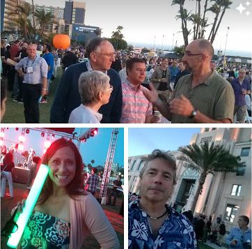
It goes without saying that Jack throws one heck of a party! ESRIUC is a huge Geeky party itself, however, the Thursday night bash always delivers and this year was no exception. It still blows my mind that year-after-year, more than 8,000 people show up and are entertained and fed without so much as a hickup! Fabulous food, craft beer carts, awesome entertainment, games, and fireworks were enjoyed by all as we used this event to network one last time with new friends and old buddies. Jack and Laura mingled as they always do, people swapped stories about what they thought was hot this year with ArcGIS (it’s all about Pro this year), and a drone errr UAV was buzzing around capturing the evening from 500 feet above (I can’t wait to see some of the footage). It was interesting to see the party located on the streets of San Diego this year, closing down several blocks along Harbor Drive right in front of the County building – and it worked well. Congrats to the party planners! See more about this year’s party HERE
Beer Maps!
Ok, I got your attention… but seriously, beer maps are not only useful and fun, they also turn heads! I’ve often thought of the beer map as the GeoGeek equivalent of the mobile developer’s “find me a coffee shop” or Hello World test project. Craft beer is all the rage, you don’t need me to tell you that, and with our annual pilgrimage to San Diego, touted by many to beer beer capital of the USA (I know, D.C, N Colorado, and PDX might argue that), there’s no better way to get attention then by mapping beer and breweries. Beer maps could be found in the Map Gallery and there was a very impressive and large Brewery Map on the wall of the exhibition hall BY @KENNETHFIELD which was popular for selfies I’m sure! Once local Geo Developer, BallPark GIS, also has an impressive San Diego County brewery webmap service which also won an award at UC this year (see more in this blog post). So, the next time you need to create an eye catching product demo, map, story map, or web service, think about routing folks to a local craft brewery!
NOTE: You can download the BeerMap HERE
Honorable mention (my way of saying more is to come on these technologies!):
- Accuweather – Much of what I saw was an enterprise offering that is geared towards the likes of National TV networks, utilities, airlines, transportation companies etc… The Accuweather down to the minute forecasting was truly awesome! See more on their new crowd-sourcing solutions in the PR they announced at the show
- Lizardtech GeoExpress 9.5 – Anyone who works with imagery HAS to be using GeoExpress in my mind. An affordable solution, this Swiss Army knife for raster data users now has even more support for LiDAR, is simple to use, and will easily save the user endless hours of time – oh, and you can get a fully functional, free eval! See www.lizardtech.com
- Kespry – This emerging company was represented in the Startup Zone and their turn key UAS solution was simply amazing! Check em out at kespry.com
- What3Words – I’ll admit I was surprised to the see the UK-based team exhibiting. These guys have serious momentum and at first you might say to yourself, “HUH?” Once you get a glimpse of how 3 simple words can make your life and business much easier I’m sure you’ll get it! Oh, and did I mention that they just lured away Gary Gale (@Vicchy) from his post at the Ordnance Survey? What these folks. See what3words.com
- VoyagerSearch – These savvy folks from Redlands, CA have a pretty awesome resource and get this, according to the team it can ingest and search over 1700 different data formats! Using their solutions a company can manage their data assets, index and find anything from the spatial and non-spatial data holdings, download, tranform, and view the results on a map – it really is impressive!
See Also:
Author: Glenn Letham, Editor, GISuser @gletham – What got your attention at the 2015 ESRIUC? Please feel free to contact me me or tweet me with your feedback, or simply leave a comment!


