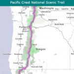
The Pacific Crest National Scenic Trail (PCT ) http://www.pcta.org/ is a treasured pathway through some of the most outstanding scenic terrain in the United States. Beginning in southern California at the Mexican border, the PCT travels a total distance of 2,650 miles through California, Oregon, and Washington until reaching the Canadian border.
National Map's Historical Topographic Map Collection – 178,000 historical topographic maps of the US
Here’s a fabulous digital archive with tens of thousands of maps for your viewing and printing pleasure! Available in time for the Fourth of July and able to be accessed on all digital devices, the USGS Historical Topographic Map Explorer brings to life more than 178,000 maps dating from 1884 to 2006. In 2009, USGS began the […]
Esri Olympic News Map – Olympic Controversies, Scandals, & Stardom
Just in time for the Sochi Olympics, a news map from Esri – this one enables users to relive 20 infamous events in the history of the Olympics, from gender discrimination in Ancient Olympia to the “whack heard ‘round the world” that almost derailed Nancy Kerrigan’s career. See Olympic Controversies, Scandals, & Stardom See Also: Winter […]
US Language Mapper Maps Where non-English Speaking Populations Live
Something new from the US Census Bureau, a handy map resource to help identify regions in the country where specific language clusters exist. According to this new resource based on the 207-2011 Community Survey Data, Spanish, Chinese Top Non-English Languages Spoken; Most of Population is English Proficient. For each language, the mapper shows the concentration […]
ESRIUC Map Gallery People's Choice Winner Inspired by Van Gogh
One of the most popular events at the annual ESRIUC each year is the Map Gallery where the works of thousands of GIS users from around the World are put on display and shared with attendees. Maps are judged and the “best” are selected based on a number of criteria. Selected maps are then featured […]
The Geography of Hate Maps Geotagged Hateful Tweets
A few days ago I sent out a tweet about some Interesting research from HSU (Humboldt State) on the geography of hate and the Hate Map of racist and homophobic tweets – interesting to see that today the maps seems to be going viral on Twitter. The map from Humboldt State U shows what they […]
Friday Fun With Maps – America As Seen by A New Yorker
How about a little Friday fun with maps and a sweet, little gem I stumbled upon today… America as viewed by a New Yorker… I just love the “empty space caused by the stupid shape of Idaho”… LOL! Got any more awesome maps and examples or cartographic brilliance to share?? Ping me @gletham with your […]
Super Bowl Fun – NFL Fan Map (FandomMap) created from Facebook data
Super Bowl week is here so that means more cool data visualizations.. best BBQ, tail gate hot spots, and those awesome NFL fan maps! Here’s details of a cool fan map – I’m not sure I can agree that its the best fan map “ever”, however, given that its been created by mashing up data […]
USGS Infographic – The water cycle for kids
How about another cool infographic for the collection? This one is loads of fun and may be a nice little addition for you to have printed out, laminated, and slapped up on the wall in the kids room… or maybe in your office for you kids at heart! The U.S. Geological Survey (USGS) and the […]
A Resource Devoted to PDF Maps for iOS
Learn all about PDF Maps, search and download map, become a PDF Maps vendor – Another fabulous resource for GeoGeeks and GeoTechs is something new from our friends at Avenza Systems. The crew has rolled out a new resource on the web at http://www.pdf-maps.com devoted to Avenza PDF Maps. The site informs you all about […]


