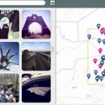
Once again, Jim and Martha from BallparkGIS have made available the very handy San Diego Gaslamp map. Add the bookmark to your mobile device or print out the map and keep it in your pocket for quick reference while you navigate the gaslamp during ESRIUC in search of food and drink
Feature – The Drones You’re Looking For: The Where of Drone Technology
The FAA is still figuring it out, and all of us who love maps are drooling over the potential of high definition photography and even virtual reality for creating high definition maps and 360 degree views of locations all over the globe. The private drone sector is exploding as smaller craft become both more affordable […]
Social Media is an Increasingly Important Part of Webmaps, Data Analysis, Analytics and Visualizations
By searching public posts, the National Geospatial-Intelligence Agency fulfills its duty to provide decision-makers with past, present and future insights into locations during a global emergency. The NGA isn’t the only agency augmenting their data analysis efforts, analysis and mapping with the inclusion of public social media feeds. There are many ways that real-time public […]


