Well, here we are on Friday and that means time for another 5 Things on Friday, my chance to share with you 5 awesome things that I’ve discovered this week. This week I’m pleased to provide tips for storing massive imagery sets, things to do in Denver, CO, visual marketing strategies, an EDU resource and more – enjoy!
Storing “massive satellite and drone imagery” on Mapbox
It seems that Mapbox wants you to store all that satellite and drone imagery in their cloud according to the company’s latest blog post. The company is courting folks with 4 GB or storage in your mapbox account. Mapbox says that within about 10 minutes your data can be uploaded, processed and made available, an idea solution for storing and serving up a huge TIFF image file. So how much data is 4 GB? Mapbox gives the following examples:
- Imagery from a one hour drone flight – have it online and shareable in 10 minutes
- A strip of imagery from Landsat 8
- 30 cm resolution aerial imagery of all of Manhattan from DigitalGlobe
- 5 meter resolution satellite imagery of a 20,000 acre farm from RapidEye
- Enough Airbus SPOT imagery at 1.5-meter resolution to cover 717,409 olympic sized trampolines
- 25 square miles of 20 cm resolution orthoimagery
Amazing Things to do in Denver
Denver, Colorado is home to many GeoGeeks and loads of awesome technology. Chances are good that at some time in the year you’ll have a chance to visit the city of Denver for a business trip or GeoTech conference. So what will you do? I’ve never had a tough time locating great things to do in my spare time in the mile high city (particularly when my Rockies are playing at home) but the folks at the New York Times have just released an amazing article with some awesome things to do and places to see – these aren’t the typical, touristy sights, rather, these are hand-picked, local favorites… great stuff here and ideas to keep you busy for 36 hours from Friday through Sunday!
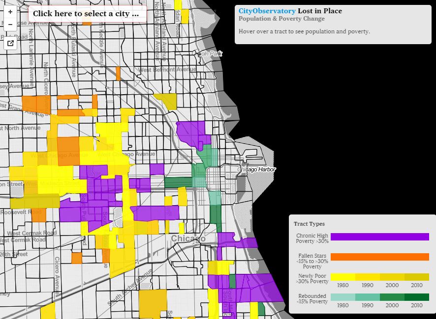
I’m an urban Geographer and have always been wow’ed reading about urban spaces and the growth of cities in North America. This fine resource is home to loads of great research including this paper that looks at how the Lost ion Place Report was created as well as the accompanying web map. Lost in Place is a report that looks at how populations have changed in the poorest urban neighborhoods over the past several decades. Note: most data has been made available for download via Tableau
Discover Spatial, Online GeoTech Education
Online EDU is all the rage.. just take a glance at some of the Google ads that are constantly pushed on you… chances are good that some or most of the are from Universities and Colleges offering online training. It’s almost impossible to keep up with the options but there’s one resource that got my attention recently (I heard about it through out LinkedIn group), enter Discover Spatial. This affordable, online learning portal offers free and low cost training in popular subject matters including PDF maps, ArcPy, Python, Map Design, and there’s even some free online training in CartoDB – nice!
Hubspot is an information-rich resource with loads of great stuff for anyone in need of tips and tricks to kickstart their marketing and social marketing efforts. Recently, Hubspot published a paper that shared 17 stats that you need to know about visual content marketing. The paper explores some of the trends that have emerged in visual content marketing and have resulted in lead conversion rates – handy stuff here!


