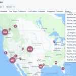
When there’s massive weather events like Hurricane Sandy there’s always a rush to access online maps and web mapping services.
People need access to elevation maps, wind scenarios, tidal information and data etc… Indeed there’s many to select from, particularly at the local level. The following are just a few of the resources that you might find useful:
- Esri hurricane map and public information map
- National Hurricane Center (NOAA) maps and satellite imagery
- Google Crisis Map for Hurricane Sandy
- MAryland Emergency Management
- MAryland Storm Surge predictions
- NOAA Storm Surge Maps
- Delaware Emergency Management
- Baltimore MD Hurricane Sandy Resources
- DHS New York division
- USGS Water Levels
- Wunderground NE SLOSH maps
- Accuweather Maps
- NorthEast Tides
- USGS Coastal erosion maps from Sandy
- CBS news storm tracker maps
- NOAA Ocean Prediction Center
- NOAA Weather.gov flood warning guages
- NYC Severe Weather Page
- New Hampshire Ready NH
- New Jersey Emergency Management
- RAMMB Imagery from Colorado State U – Hurricane Sandy image resources and loops
- NJ Hurricane Map from the New Jersey State Atlas
- Map of operational gas stations in New Jersey
- NYC OpenData WiFi locations
- NYC OpenData Resource
- NJ DEP Data Downloads
- NJ OEM Status Updates
- NYC OEM
- Esri AfterMap from Esri Reveals Pre and Post Sandy NOAA Imagery
- Did we miss something? Send a tweet to @GISuser or @gletham
Power Outage Maps:
Esri has shared a number of useful maps and data resources of interest to those needing information in the wake of Hurricane Sandy. Several maps have been archived in the gallery and one particularly useful resource is a map directing users to additional maps and outage maps from electric companies in the stricken areas. See more info HERE.
Some useful maps and map resources from electric companies include:
- Atlantic City Electric Power Status Map
- Long Island Power Authority Power Status Map
- Con Edison of New York Power Status Map
- PSE&G Power Status Map
- Jersey Central Power & Light Power Status Map
- Delmarva Power Status Map
- NYSEG Outage Viewer Map Service
- Dominion Power (VA) Outage Map Service
- MEMA Maryland Outage maps
Google Crisis Map
See Also:
- Open Data & Online GIS Publication Platforms Empower Individuals Mapping Hurricane Sandy
- Hurricane Sandy: The AfterMap from Esri Reveals Pre and Post Sandy NOAA Imagery
- Sandy CrisisCamp – design, code, and learn with other people this weekend at a CrisisCamp!
Source: Uploaded by user via Glenn on Pinterest


