New platform will provide a deeper understanding of topics that impact on our lives
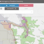
Data Tip – The US Interagency Elevation Inventory
The USGS liaisons are updating the United States Interagency Elevation Inventory (https://coast.noaa.gov/inventory/#). This resource also provides a wealth of information and data
40 Years of North Pacific Seabird Survey Data Now Online
ANCHORAGE, Alaska — The U.S. Geological Survey today released the North Pacific Pelagic Seabird Database — a massive online resource compiling the results of 40 years of surveys by biologists from the United States, Canada, Japan and Russia. The database documents the abundance and distribution of 160 seabird and 41 marine mammal species over a 10 million-square-mile region of […]
OpenAerialMap – The open collection of aerial imagery
An interesting data tip came into yours truly over Twitter via user @RSchultzSNHU introducing us to a data resource called OpenAerialMap
Data Tip – USGS LandsatLook Viewer
So, you’re interested in Landsat imagery for any place on Earth… well look no more!
TopoView – explore, view, download more than 178,000 USGS legacy topo maps
The USGS National Map program, working with theNational Geologic Map Database (NGMDB) project, has launched a new version of the beta application, topoView for exploring, viewing and downloading the more than 178,000 USGS digitized legacy topographic maps from the USGSHistorical Topographic Map Collection (HTMC)
Device Spotlight – Trimble R1 GNSS Receiver
The Trimble® R1 is a rugged, compact, lightweight GNSS receiver that provides professional-grade positioning information to any connected mobile device using Bluetooth® connectivity.
USGS maps – More Than 18 Million Served
USGS maps have been downloaded by the millions since converting to digital delivery.
Landsat on AWS, start adding Landsat layers to your maps
An interesting data update comes to us via Esri and amazon – Landsat on AWS
Data Tip – Customized Coverage from LandScan Global Population Database
In search of a population database to support your GIS and mapping needs? The folks at East View are now offering customized clip-outs from the LandScan Global Population Database to suit your specific data coverage needs.


