There’s many maps, webmaps and web resources available online to support the response to Hurricane Irma. These range for traffic maps, evacuation routes, shelter locations, wind speed and direction information and much more. The following is a sample of some map resources that have been compiled by the crew at GEO Jobe
Feature – States’ Rights: A Sure Bet on Location
This October, the Supreme Court will hear a landmark case on the repeal of the Professional and Amateur Sports Protection Act (PASPA) passed by Congress in 1992. The act prohibits sports betting in all states except Nevada, Oregon, Montana, and Delaware. These states were grandfathered in, and therefore exempt to the law.
MapThis shares Wildfire Maps – Maps, WebMaps and Resources for #BCwildfire Updates
From GEO Jobe GIS – Recall, recently we shared the story of how our friends and colleagues at Esri small business startup, Echosec, supported their lead developer in building a BC wildfire public information ArcGIS online resource in order to help keep the public informed and safe. Building on that and after searching for additional resources, the […]
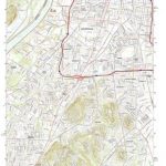
Updated US Topo maps for Kentucky from the USGS
New US Topo maps for Kentucky are now available in the USGS Store for free download. One of the main improvements is the inclusion of the U.S. Census Bureau’s Topologically Integrated Geographic Encoding and Referencing (TIGER) road data.
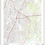
New Maps for Texas and Oklahoma Released
Updated US Topo maps for Texas and Oklahoma available for download; add Census Bureau road data, wetlands layer and select trails
Chatty Maps – mapping the sound of the city and urban sounds!
An interesting project from ChattyMaps enables users to visualize the sounds of the city. Browse the urban sound maps to view an index rating of the dominant sounds for any street within the range of the project.
Map of the Day – Is it Illegal to Drive… ?
A fun map of sorts conveys information about where certain activities are illegal when behind the wheel of a car.
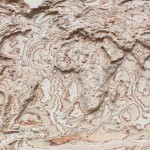
Map of the Day (MOTD) – 3D Wooden Maps
Here’s a fun and unique addition to our MOTD collection… not simply a map but how about 3D wooden maps? Yes indeed, this cool woodworking shop can turn any map into a beautiful, custom, 3D wooden work of art!
HERE Map Creator Enables Users to Update the Map
Something of interest from HERE… HERE Map Creator is a tool for communities all over to update the map with missing or incorrect information; contributing to making the HERE map as fresh and accurate as possible.
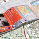
Ordnance Survey encourages people to use up-to-date maps with their trade-in scheme
Outdoors enthusiasts can build impressive collections of Ordnance Survey maps, but it often means they’re not using the most up-to-date maps to get outside and explore Britain. Up until 20 March, OS is offering avid explorers the chance to return their old maps and receive money off new map purchases in return.

