LONDON, United Kingdom, 10 February 2016 – Many smaller housing associations could be missing out on the benefits of using geographic information simply because they are unable to justify employing a dedicated mapping expert. Recognising this, British GIS and web mapping software developer, Cadcorp, is introducing a service designed specifically for housing associations that manage less than 10,000 properties.
The new service will be launched at today’s IT and Housing Exhibition. Martin McGarry, managing director, Cadcorp, said “Under the service the responsibility for managing both map data and web mapping software sits with Cadcorp. The housing association simply subscribes to a service that includes software, data and management services”.
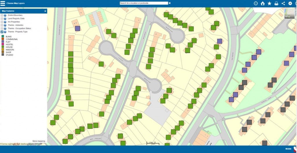
The service provides a housing association with internet access to Cadcorp’s flagship web mapping product, Web Map Layers. It is an easy-to-use off-the-shelf application for presenting and interrogating spatial data. The software is hosted on Microsoft’s secure cloud platform, Microsoft Azure, and Cadcorp partner, emapsite™, supplies mapping data sourced from Ordnance Survey® – both detailed licenced data and open data.
Cadcorp will work closely with the housing association to set up and configure the application, and manages the software and data updates on the customer’s behalf for the duration of a project. Cadcorp will also work with the housing association to manage its own business data accessed through web mapping. This can include both static data (typically details about assets) as well as more dynamic data (such as voids, arrears and repairs).
“The outcome” continued Mr. McGarry “is that for smaller associations, there is now a hosted web mapping proposition which can be cheaper, faster, and more cost-effective than an in-house alternative.”
Read more about hosted web mapping for smaller housing associations here
You can try an on-line demonstrator here
About Cadcorp
Cadcorp is a British software development company focused on geographic information system (GIS) and web mapping software. It offers a complete suite of products – the Cadcorp Spatial Information System® (Cadcorp SIS®) – addressing all phases of spatial information management. In the UK, more than thirty social housing providers use Cadcorp software. To find out more, please visit www.cadcorp.com


