Contex and National / AZON will premiere the Zero Turn Productivity Center with the Contex IQ Quattro X large format scanner in an upcoming webinar to be held February 24th at 11 AM Eastern.
Webinar Tip – Getting Started with D3.js for Data Visualization
Getting Started with D3.js for Data Visualization
Webinar – Processing Large Drone Projects Webinar
The rapid processing of large drone projects (e.g. tens of thousands of images) presents significant challenges to the drone mapping industry.
senseFly launches eBee e-learning platform and operator certification program to advance drone knowledge
CHESEAUX-SUR-LAUSANNE, Switzerland, 12th January 2021 – senseFly, the global leader in fixed-wing drones, today unveils the launch of its new e-learning platform and dedicated Certified senseFly Operator Program, developed to equip unmanned aerial vehicle (UAV) operators with the knowledge and skills required to carry out drone missions more accurately, safely and efficiently.
Enter the LIDAR Drone Mapping Arena at Minimal Risk
When: Wednesday, December 9, 2020 – Time: 10AM – 11AM CDT
Webinar – How to Accurately Merge Imagery with LiDAR
Webinar – How to Accurately Merge Imagery with LiDAR, Thursday, December 10th
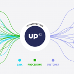
UP42 Hosts Webinar on Fusion of Satellite Imagery, AIS Data, Machine Learning for Maritime Surveillance
BERLIN, Germany, 30 November 2020 – UP42, creator of the leading developer platform for Earth observation data and analytics, will host a free webinar on maritime monitoring and surveillance on Dec. 9, 2020. Presentations will discuss the integration of optical and radar satellite imagery with Automatic Identification System (AIS) ship tracking data for analysis using machine […]
Webinar – Improving your Photogrammetric Workflow with New Version 8.6
SimActive will release a new version of its photogrammetry software Correlator3D. The new version includes multiple new features, such as the use of intensity data from LAS files for image registration, the ability to improve mosaic seamlines with a DSM and the support of DJI sun sensors.
Webinar: From Flight to Finish with True View & Pix4D
Join us for a partnered webinar with Pix4D as we overview our “From Flight to Finish” workflow featuring GeoCue’s True View 3DIS and Pix4Dmapper.
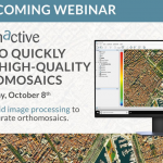
Webinar – How to Quickly Generate High-Quality Orthomosaics
free webinar ‘How to Quickly Generate High-Quality Orthomosaics” – Learn about rapid image processing to produce accurate orthomosaics from SimActive.


