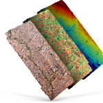
Customers can now task drones and browse drone data next to other types of imagery, all in one place.
UP42 and Umbra Unveil Partnership at World Satellite Business Week, Enhancing Environmental, Asset, and Land Monitoring
Geospatial leaders release a special video to explain the benefits of easier access to high resolution SAR data.
UP42 and ImageSat International (ISI) Partner to Unlock Critical Applications of Geospatial Data
From disaster response to environmental monitoring, operators in essential sectors will have direct access to high-resolution optical imagery.
UP42 and Vexcel Team Up to Expand Aerial Imagery and Geospatial Data Portfolio on the Marketplace
High-resolution and Accuracy in 30+ Countries for Utility, AEC, Energy, Insurance, and Telecoms Applications
UP42 Launches ArcGIS Pro Add-in as Part of Esri Partner Network
ArcGIS users have direct access to the UP42 platform for easier data visualization and analysis
UP42 Achieves Sustainability Partner Designation in the Google Cloud Partner Advantage Program
Google Cloud Recognizes UP42 as Part of Google Cloud Ready – Sustainability Program
UP42 Adds BlackSky Dynamic Monitoring to Marketplace
On-demand access to low-latency dawn-to-dusk imagery
UP42 Teams Up with Trimble for Faster Information Extraction from Geospatial Data
Automation to Enhance Feature Extraction, Change Detection on the UP42 Platform
UP42 Announces Thetaspace as Copernicus Masters Challenge Winner with Solution to Cloud Cover in EO Data
CloudlessEO Algorithm Fills in Clouds and Shadows in Optical Satellite Imagery
UP42 Unveils Very High-Resolution Imagery from Airbus Pléiades Neo Satellites
Enhancing Applications in Utilities, Insurance, Agriculture, Government
